Parícutin Volcano Grew 1,391 Feet From a Mexican Farmer’s Cornfield
Mexico's Parícutin volcano rose 1,391 feet from a cornfield between 1943 and 1952. How scientists tracked it, and the two villages its lava covered.
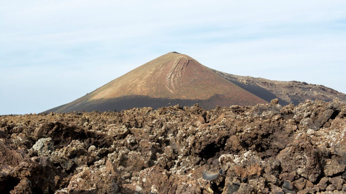
Parícutin, a volcano born in a Michoacán cornfield in 1943, ended its nine-year eruption in 1952 as a cone 1,391 feet high. Earth.com retold its story this week, drawing on the International Union of Geological Sciences (IUGS), which says no earlier eruption had been followed closely by modern researchers from the moment a volcano appeared.
Lava from the new mountain eventually swallowed two villages, and their people never returned.
The afternoon the field opened
On Feb. 20, 1943, Dionisio Pulido was getting land he had farmed for 31 years ready for sowing. Around 4 p.m., while burning a heap of branches, he noticed a crack roughly half a meter deep. Soon the soil near it bulged upward by 2 to 2.5 meters. Gray dust or smoke came out with a loud, unbroken whistle, and the air smelled of sulfur. Paula, his wife, had already been hearing rumbling below ground. Scared, Pulido rode his horse to the village where his family waited.
Years later, Smithsonian mineralogist William F. Foshag and Mexican geologist Jenaro González R. took down what both spouses remembered. Their English translation appeared in a U.S. Geological Survey bulletin in 1956.
Tremors gave a warning
For roughly two weeks before the eruption, starting somewhere between Feb. 5 and 7, residents felt the ground shake. The tremors kept growing, and on one day more than 200 hit the area, according to Felipe Cuara Amezcua, who led the municipality of San Juan Parangaricutiro at the time. Volcanologists I. Yokoyama and S. de la Cruz-Reyna studied those early quakes in 1990 as a signal that can precede an eruption.
A mountain built in days
An early photo, shot at 6 p.m. on the opening day, captures ash climbing from the vent. The pile stood about 6 meters tall by midnight. The next morning a powerful quake set off panic, and Parícutin’s residents ran to San Juan Parangaricutiro; many people there kept going to Angahuan or Uruapan. A picture from that day shows the cone near 30 meters, barely topping the trees.
Six days in, it reached 167 meters. By the close of the first phase on Oct. 19, 1943, the original vent had piled up a cone of roughly 365 meters.
Lava moved slowly. Ezequiel Ordóñez, a Mexican geologist, put the early pace of the Quitzocho flow at around 3 meters an hour as it spread north across farmland. Falling ash lay over 15 centimeters thick across some 300 square kilometers.
Two villages lost
Pulido’s village sat just 3 kilometers from the cone. Its 733 people had to leave permanently four months into the eruption, and lava later rolled over the place. Beginning in January 1944, fresh activity fed the Taquí flows, which covered about 18 square kilometers by 1945. Lava closed around the San Juan Parangaricutiro church in July 1944; according to the IUGS, its tower still sticks up out of the rock.
By the end, lava had traveled as far as 4 kilometers from the vent, leaving a field near 25 square kilometers in size. Families who lost their homes got new land from the Mexican government at Caltzontzín, 27 kilometers southeast.
Why it matters for volcano science
Geologists call Parícutin a monogenetic cone: one that forms in a single eruptive episode and then goes quiet. A 1993 USGS film report described it as the first such eruption in historical time to be well documented. Its nine-year run let an international group watch one of these volcanoes from start to finish. Celedonio Gutiérrez, who lived in San Juan and began a diary on the first day, helped U.S. researchers the whole time.
Heat lingered for decades. A fumarole (a crack that vents volcanic gas) at the site registered 473°C in 1985. The Smithsonian Institution’s Global Volcanism Program counts Parícutin among more than 1,400 vents in the Michoacán-Guanajuato volcanic field.
Source: Earth.com