Lake-Effect Snow Explained: Why Some Towns Get Buried
Lake-effect snow forms when cold air crosses a warmer lake and drops narrow bands of heavy snow downwind. Why snowbelts get buried and when it peaks.
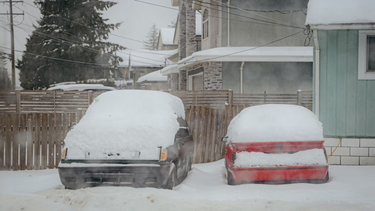
Lake-effect snow is snow made by a lake: very cold air blows across a large body of relatively warm, unfrozen water, picks up heat and moisture, and drops it as heavy snow on land downwind. The snow falls in narrow bands, often only a few miles to about 20 miles wide, so one town can get several feet while a town 15 miles away sees sunshine. The Great Lakes produce the most famous lake-effect storms, and the snowiest spots east of the Rockies sit on their downwind shores.
How does a lake make snow?
A lake makes snow by warming and moistening the bottom of a cold air mass. In late fall and early winter the Great Lakes still hold summer heat, so the water can be far warmer than arctic air arriving from Canada. When that air flows over the lake, several things happen in order:
- Heat from the water warms the lowest layer of air, which becomes lighter than the air above it and starts to rise.
- Water evaporates from the lake surface into the rising air.
- As the air rises it cools, and the added moisture condenses into clouds.
- The clouds grow tall enough to produce snow, which reaches the ground once the air moves back over land.
Forecasters at the National Weather Service look for a large temperature gap between the lake surface and the air about a mile up. A difference of roughly 23°F (13°C) is the usual rule of thumb for lake-effect snow to start, and bigger gaps produce more intense bands.
Why do some towns get buried while others stay clear?
Wind direction decides who gets buried. A lake-effect band lines up with the wind, so whichever town sits at the far end of the longest stretch of open water takes the full load. Three factors set how much snow falls there:
- Fetch, the distance the wind travels over open water. A longer path gives the air more time to gather heat and moisture. Bands that run the length of Lake Erie or Lake Ontario are the strongest.
- Wind steadiness. If the wind holds the same direction for a day or more, the band parks over the same towns and totals pile up fast. A shifting wind spreads the snow around.
- Hills downwind. Rising ground forces the air up again, squeezing out extra snow. The Tug Hill Plateau east of Lake Ontario averages more than 200 inches of snow a year for this reason.
Inside a strong band, snow can fall at 2 to 3 inches (5 to 8 cm) an hour or more, sometimes with thunder and lightning. Outside the edge of the band, skies can be partly sunny.
Where does lake-effect snow happen?
The snowbelts of the Great Lakes are the best-known places. Prevailing winds in winter blow from the west and northwest, so the snowiest areas lie on the eastern and southern shores:
- Buffalo and the southern suburbs, downwind of Lake Erie
- Erie, Pennsylvania, and the hills east of Cleveland, Ohio
- Syracuse, Oswego and the Tug Hill Plateau, downwind of Lake Ontario
- Western Michigan, downwind of Lake Michigan
- Michigan’s Upper Peninsula, along Lake Superior
The same process works elsewhere when cold air crosses open water. The Great Salt Lake in Utah sets off lake-effect storms, and western Japan gets very heavy “sea-effect” snow when Siberian air blows across the Sea of Japan. Hudson Bay and the Black Sea produce similar snow before they freeze. The NOAA Great Lakes Environmental Research Laboratory tracks lake temperatures and ice cover, which shape each season.
When is lake-effect season?
Lake-effect season usually runs from November through January, with the heaviest storms often in late fall and early winter. That is when the lakes are still warm and the first arctic outbreaks arrive, so the temperature gap is widest. The season winds down once a lake freezes over, because ice cuts off the heat and moisture. Lake Erie, the shallowest Great Lake, freezes most often and loses its snow machine earliest. Lake Ontario and Lake Superior rarely freeze completely, so their snowbelts can get lake-effect snow all winter.
How much snow can one storm drop?
A single lake-effect event can drop several feet. In November 2014 a band off Lake Erie buried parts of the Buffalo area’s southern suburbs under more than 6 feet of snow over a few days, while downtown Buffalo, a few miles north, got far less. Totals like these are possible because a parked band keeps feeding the same area for many hours. The snow is often light and fluffy at first, but its weight on roofs adds up quickly over a long event.
How do forecasters predict lake-effect snow?
Forecasters predict lake-effect snow by combining the lake temperature, the air temperature aloft and the expected wind direction. The temperature gap tells them whether snow will form, and the wind direction tells them where the band will set up. Pinning down the exact location is the hard part: a small change in wind direction moves the band by miles. Warnings for lake-effect snow therefore often name specific counties or even parts of counties, and the National Weather Service issues dedicated lake-effect snow warnings for the Great Lakes.
How can people in snowbelts stay safe?
People in snowbelts stay safer by watching for lake-effect warnings and planning around the band. Useful steps:
- Avoid driving into a band when a warning is out. Visibility can drop to near zero within a short distance, and roads can go from clear to snow-covered in minutes.
- Keep a winter kit in the car: a scraper, a shovel, blankets, water, snacks and a phone charger.
- Clear snow from roofs, vents and exhaust pipes after a long event, and never run a car or generator in a closed garage.
- Pace snow shoveling and take breaks, since heavy shoveling is hard physical work.
Road crews in snowbelt cities lean heavily on salt and brine. Why road salt melts ice comes down to how dissolved salt lowers the freezing point of water, and that same salt speeds up rust on cars and steel, so regular washing of a car’s underside helps in a snowy winter.
Quick answers
Is lake-effect snow the same as a regular snowstorm?
No. A regular snowstorm comes from a large low-pressure system and covers a wide region. Lake-effect snow forms locally over open water and falls in narrow bands, often under otherwise fair skies.
Can small lakes cause lake-effect snow?
Small lakes can produce light flurries, but heavy lake-effect snow needs a large lake and a long fetch. The Great Lakes and the Great Salt Lake are big enough to make significant storms.
Does climate change affect lake-effect snow?
Warmer lakes that freeze later can extend the lake-effect season, while milder air reduces the temperature gap needed for snow. Researchers are still measuring how these effects balance out in different snowbelts.
What is thundersnow?
Thundersnow is thunder and lightning during snowfall. It happens in the strongest lake-effect bands, where rising air is vigorous enough to build charge, and it usually signals very heavy snow rates.