How Tornadoes Form and Why the US Gets So Many of Them
A tornado starts with wind that changes speed and direction with height and a storm strong enough to stand that spin on end. Here is how it happens, where and when, and how the EF scale rates the damage.
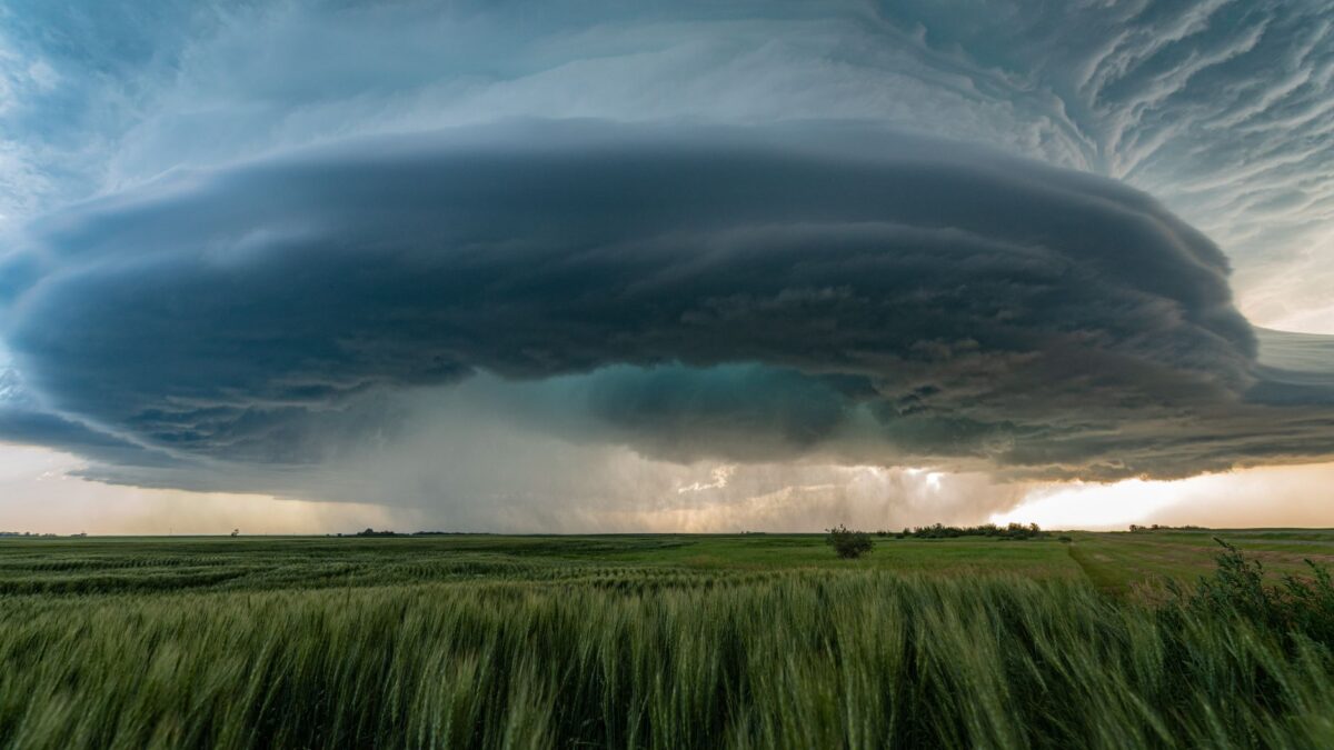
Most tornadoes, and nearly all violent ones, form inside supercells: thunderstorms with a deep, rotating updraft called a mesocyclone. The rotation starts when winds change speed and direction with height, and the storm’s updraft tilts that spinning air upright. NOAA says around 1,200 tornadoes strike the United States in a typical year, more than anywhere else in the world.
Even so, scientists still do not fully understand why one supercell drops a tornado and a nearly identical one does not. NOAA’s National Severe Storms Laboratory calls tornado formation an open research question.
What ingredients does a tornado need?
Forecasters at NOAA’s Storm Prediction Center look for four ingredients: moisture, instability, lift and wind shear. When all four overlap, thunderstorms can grow tall, last for hours and rotate.
- Moisture: warm, humid air near the ground, often flowing north from the Gulf.
- Instability: warm air at the surface under much colder air aloft, so rising air keeps accelerating upward.
- Lift: a cold front, dry line or other boundary that pushes the air up to start storms.
- Wind shear: winds that strengthen and turn with height.
The common shorthand, warm Gulf air meeting cold Canadian air and dry air from the Rockies, is what the Storm Prediction Center itself calls a gross oversimplification. Storms can produce tornadoes without a dramatic clash of air masses if the shear and moisture are right.
How does a thunderstorm start to rotate?
Rotation begins with wind shear near the ground. Picture wind blowing faster a few thousand feet up than at the surface: the air between rolls over like a pencil between your palms, making a horizontal tube of spinning air.
- Wind shear creates a horizontal roll of spinning air in the lower atmosphere.
- A strong thunderstorm updraft lifts part of that roll and tilts it upright.
- Winds that also turn direction with height strengthen the spin, and a rotating updraft, the mesocyclone, forms inside the storm.
- Downdrafts wrap around the back of the storm. On radar, the rear-flank downdraft can make a “hook echo.”
- In some storms, rotation near the ground tightens into a narrow, intense vortex that touches the surface: a tornado.
NOAA’s JetStream guide to tornadoes explains that strong vertical shear, combining speed shear and veering winds, is the setup most favorable for supercells. NSSL notes that a lowered, rotating wall cloud may hang under the storm for 10 to 20 minutes before a tornado appears, though many wall clouds never produce one.
Why does the US get so many tornadoes?
The central US combines the four ingredients more often than anywhere else. NOAA says more tornadoes strike the central United States than any other place in the world. In spring, the broad, flat interior lets warm, humid air from the Gulf flow far north underneath strong winds aloft, which gives storms both fuel and shear.
Other countries get tornadoes too. NSSL notes that Argentina and Bangladesh have some of the highest concentrations outside the US. Records also matter: official US counts begin in 1950, and better radar and storm spotting mean more weak tornadoes are recorded now than decades ago, so NSSL cautions that the true long-term average is not known.
Where are Tornado Alley and Dixie Alley?
Tornado Alley is a media nickname for a broad area of frequent tornadoes in the central US, roughly the southern and central Plains. NSSL warns that the label can mislead: tornadoes have been reported in all 50 states, and the zone of highest risk shifts through the year.
Dixie Alley is the name for a second hot spot across the lower Mississippi and Tennessee valleys. A National Weather Service climatology study defined it as Louisiana, Arkansas, Mississippi, Alabama, Tennessee and Georgia. Tornadoes there are often hidden by rain, trees and hills, and many strike at night. An NWS Memphis office study found that 42% of Mid-South tornadoes from 2007 to 2020 happened between 6 p.m. and 6 a.m. Research summarized by the NWS Louisville office, found tornado frequency decreasing in parts of the Great Plains and increasing in the Southeast over recent decades.
When do tornadoes happen?
Tornado season peaks in spring and early summer, but the timing depends on region. NSSL says the southern Plains peak from May into early June, the Gulf Coast earlier in spring, and the northern Plains and upper Midwest in June or July. In the Southeast, strong tornadoes can also hit in late fall and winter.
Time of day matters too. NSSL says most tornadoes occur between 4 and 9 p.m., when the ground has heated all day. The Storm Prediction Center says most last less than 10 minutes, though some last only seconds and a few longer than an hour.
How is tornado strength measured on the Enhanced Fujita scale?
Tornadoes are rated after the fact from the damage they leave, using the Enhanced Fujita (EF) scale, which took effect in the US on Feb. 1, 2007. Surveyors compare what they find against 28 damage indicators, such as types of homes, schools and trees, to estimate the wind speed.
| Rating | Estimated 3-second gust |
|---|---|
| EF0 | 65-85 mph (105-137 km/h) |
| EF1 | 86-110 mph (138-177 km/h) |
| EF2 | 111-135 mph (178-217 km/h) |
| EF3 | 136-165 mph (218-266 km/h) |
| EF4 | 166-200 mph (267-322 km/h) |
| EF5 | Over 200 mph (over 322 km/h) |
Wind speeds from the Storm Prediction Center’s EF scale page. A tornado over open fields may get a low rating simply because it hit little that could be damaged. Mobile Doppler radar has measured far higher winds inside tornadoes: the Storm Prediction Center cites a reading of roughly 302 mph a short distance above the ground in the Bridge Creek-Moore, Oklahoma, tornado.
What is the difference between a tornado watch and a warning?
A tornado watch means conditions favor tornadoes; a tornado warning means one has been reported or detected on radar and you should take shelter now. The Storm Prediction Center issues watches, which often cover parts of several states for several hours. Local National Weather Service offices issue warnings for specific counties or areas.
During a warning, the standard NWS advice is to go to a basement or an interior room without windows on the lowest floor, and to leave mobile homes and vehicles for a sturdy building if there is time. Tornado safety pages at weather.gov list what to do in different buildings. Storm chasing is dangerous and not something to try. Lightning from the same storms is its own hazard, covered in what causes lightning.
Bottom line
Tornadoes grow from rotating supercell thunderstorms: wind shear makes spinning air near the ground, and a strong updraft stands it upright. The central US sees more tornadoes than anywhere on Earth, about 1,200 a year, with a second hot spot in the Southeast where night tornadoes are common. The EF scale rates them from damage, from EF0 to EF5.
FAQ
Can tornadoes happen in winter?
Yes. The Gulf Coast and Southeast can see tornadoes in any month when warm, humid air and strong winds aloft line up, including outbreaks in December and January.
Do tornadoes avoid cities or rivers?
No. Tornadoes have crossed large cities, rivers and hills. Cities cover a small share of the land, so they are hit less often, but not because of any protection.
Should you open windows to equalize pressure?
No. NWS advice is to skip it and get to shelter. Opening windows wastes time and does not protect the building.
How long does a tornado warning give you?
It varies with each storm. Some warnings come many minutes before a tornado arrives, while tornadoes wrapped in rain or forming quickly may give much less time, which is why acting at once matters.