How Hurricanes Form, From Warm Ocean Water to the Eye
From space a hurricane looks like a pinwheel of cloud around a dark, calm hole. It starts as a loose cluster of thunderstorms over warm tropical water.
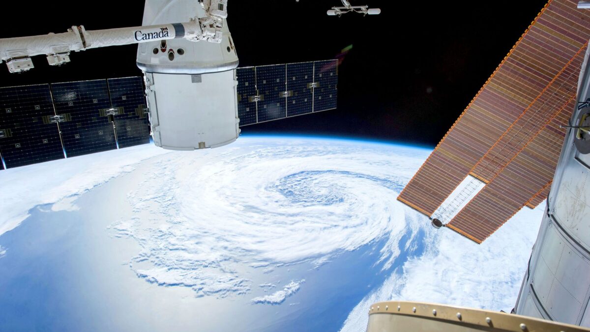
A hurricane forms when a cluster of tropical thunderstorms sits over ocean water of at least 26.5°C (about 80°F) to a depth of about 50 meters (164 feet), in air with little change in wind with height. Heat released by condensing water vapor feeds the storm, the Earth’s rotation makes it spin, and once sustained winds reach 74 mph (119 km/h) it is classed as a hurricane.
Seen from a satellite, a mature hurricane is a spiral of cloud hundreds of kilometers across, wrapped around a small, often clear eye. Most of what makes that shape happens out of sight, in the warm water beneath it.
What ingredients does a hurricane need?
A hurricane needs warm, deep ocean water, moist air, a starting disturbance and weak wind shear. NOAA’s National Ocean Service lists them in its explainer on how hurricanes form:
- A trigger. Many hurricanes start as a tropical wave, a ripple of low pressure moving through the trade winds.
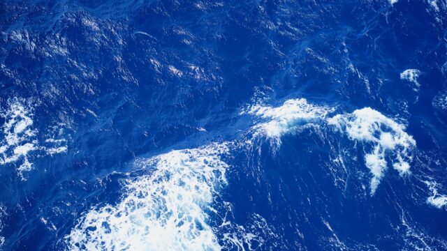
- Warm water. Water at least 26.5°C over a depth of 50 meters supplies the heat and moisture.
- Thunderstorms. They turn ocean heat into energy the storm can use.
- Low wind shear. A large change in wind speed or direction with height tears the developing storm apart.
Even when everything lines up, a hurricane does not always develop. Forecasters watch many tropical waves each season, and only a fraction grow into named storms.
How does a hurricane get its energy?
A hurricane runs on heat from the ocean. Warm, moist air rises over the sea surface and leaves lower pressure beneath it, which draws in more air from around it. As the rising air cools, its water vapor condenses into cloud droplets and releases heat. That heat warms the air further, so it rises faster and pulls in still more moist air.
The loop keeps going as long as the storm stays over warm water. Move it over land or cold water and the fuel supply drops, which is why hurricanes usually weaken after landfall. Thunderstorms inside the storm also produce lightning; how storm clouds build up charge is explained in what causes lightning.
Why do hurricanes spin, and what is the eye?
Hurricanes spin because of the Coriolis effect, the apparent deflection of moving air caused by the Earth’s rotation. Air rushing toward the low-pressure center is turned to one side, so it curls around the center instead of flowing straight in. In the Northern Hemisphere that produces counterclockwise rotation; in the Southern Hemisphere, clockwise. The effect is very weak near the equator, which is why tropical cyclones rarely form there.
At the center sits the eye, which the National Hurricane Center defines in its glossary as the roughly circular area of comparatively light winds around the center of a severe tropical cyclone. Around it is the eyewall, an organized ring of tall thunderstorm clouds. The eyewall is where the strongest winds and heaviest rain are usually found, so the calm of the eye passing overhead is a pause, not the end.
What do the hurricane categories mean?
Hurricanes are ranked 1 to 5 on the Saffir-Simpson Hurricane Wind Scale, based only on maximum sustained wind speed. The ranges below are from the National Hurricane Center.
| Category | Sustained winds | Typical damage (NHC summary) |
|---|---|---|
| 1 | 74–95 mph (119–153 km/h) | Some damage to roofs, siding and gutters; large branches snap; power out for days |
| 2 | 96–110 mph (154–177 km/h) | Major roof and siding damage; many shallow-rooted trees down; near-total power loss for days to weeks |
| 3 (major) | 111–129 mph (178–208 km/h) | Devastating damage; electricity and water out for days to weeks |
| 4 (major) | 130–156 mph (209–251 km/h) | Catastrophic damage; loss of most of the roof or some walls; areas uninhabitable for weeks or months |
| 5 (major) | 157 mph (252 km/h) or higher | Catastrophic damage; a high percentage of framed homes destroyed |
The scale leaves out some of the deadliest hazards. It does not account for storm surge, the abnormal rise in sea level that pushes ocean water inland, or for rainfall flooding and tornadoes. A slow-moving storm of any category can drop enough rain to cause severe flooding. Hurricanes can spawn tornadoes as they come ashore; how those form is covered in how tornadoes form.
Is a hurricane the same as a typhoon or a cyclone?
Yes, they are the same kind of storm with different names by region. According to NOAA’s National Ocean Service, the word hurricane is used in the North Atlantic and the central and eastern North Pacific. The same storm in the Northwest Pacific is a typhoon. In the South Pacific and Indian Ocean the general term tropical cyclone is used. Meteorologists call all of them tropical cyclones.
When is hurricane season, and why does it peak in September?
The Atlantic hurricane season runs from June 1 to November 30, and its statistical peak is September 10, according to NHC climatology. Most activity falls between mid-August and mid-October. The eastern Pacific season starts earlier, on May 15, and also ends November 30.
The late-summer peak follows the ocean: seawater warms slowly, so the tropical Atlantic is usually at its warmest late in the season. Based on the 1991–2020 climate period, an average Atlantic season brings 14 named storms, 7 hurricanes and 3 major hurricanes.
What is the difference between a hurricane watch and a warning?
A hurricane watch means hurricane conditions are possible; a warning means they are expected. The National Hurricane Center issues a watch 48 hours before tropical-storm-force winds are expected to arrive and a warning 36 hours before. Both lead times are counted from the expected arrival of tropical-storm-force winds, not hurricane-force winds.
- Tropical storm watch: winds of 39–73 mph possible within 48 hours.
- Hurricane watch: winds of 74 mph or more possible; issued 48 hours ahead.
- Tropical storm warning: winds of 39–73 mph expected within 36 hours.
- Hurricane warning: winds of 74 mph or more expected; issued 36 hours ahead.
Follow the National Hurricane Center and your local National Weather Service office for current advisories, and local emergency officials for evacuation orders.
Bottom line
A hurricane is a heat engine. It needs ocean water of at least 26.5°C, moist air, weak wind shear and enough distance from the equator to spin. The category tells you the wind speed, but storm surge and rain are often the bigger danger. Changes in Pacific Ocean temperatures also shift Atlantic hurricane odds from year to year, as explained in El Niño and La Niña explained.
FAQ
Why do hurricanes weaken over land?
Over land, a hurricane loses its supply of warm, moist ocean air. Friction with the ground also slows the winds, although heavy rain can continue far inland.
What wind speed makes a storm a hurricane?
A tropical cyclone becomes a hurricane when its maximum sustained winds reach 74 mph (64 knots, 119 km/h). Below that, from 39 to 73 mph, it is a tropical storm and gets a name.
Which hurricane categories count as major?
Categories 3, 4 and 5 are major hurricanes, with sustained winds of 111 mph (178 km/h) or more. The NHC notes that they can cause devastating to catastrophic damage.
Can hurricanes form at the equator?
Very rarely. The Coriolis effect that makes the storm spin is close to zero at the equator, so organized rotation is hard to start there.