Atmospheric River Rated AR-4 Targets B.C. With 300+ mm of Rain
A strong AR-4 atmospheric river is forecast to bring 200-300+ mm of rain to parts of B.C., with flood watches and an evacuation alert in Pemberton.
A strong atmospheric river rated AR-4 is forecast to hit British Columbia’s already-soaked coast, with 200-300+ mm of rain possible on western Vancouver Island and the North Shore, according to The Weather Network. The forecast calls for the heaviest rain to start Tuesday afternoon and continue through Wednesday.
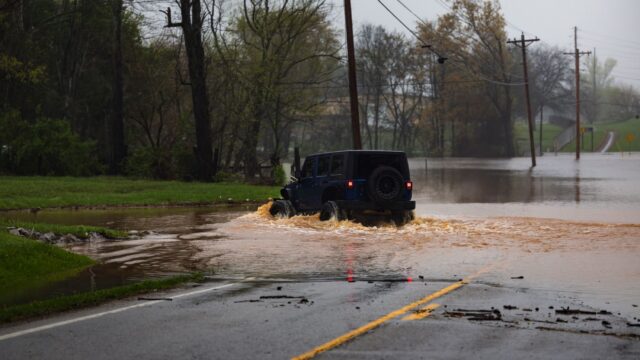
The B.C. River Forecast Centre has issued flood watches for much of the coastal region. The Village of Pemberton has put an evacuation alert in place for properties in the Airport Road area because of high river flows and heavy precipitation.
What an AR-4 rating means for the coast
An atmospheric river is a long, narrow band of moisture that carries water vapor across the ocean and releases it as rain when it meets land. The Weather Network says this one is rated AR-4, which in its description means prolonged heavy rain and impacts for a coast that has already taken a soaking. Several slow-moving frontal systems accompany it, and forecasters expect the rain to keep falling through Thursday, with lingering showers for the rest of the week.
The weekend before it arrived was already rough. Multiple storm systems brought heavy rain and strong winds across the province, which led to ferry cancellations and a landslide.
Rainfall totals by region
- Western Vancouver Island and the North Shore: 200-300+ mm possible.
- East Vancouver Island: 100-200 mm possible.
- The rest of the Lower Mainland: 50-100+ mm possible by Wednesday.
Thunderstorms embedded in the system could push totals higher in some spots over the two days, according to the forecast. The Weather Network also said a rainfall warning could be issued Tuesday, since the system may cause localized flooding and more power outages.
Wind, tides and rising rivers
Gusts of 60-70+ km/h are forecast along the coast and into the Strait of Georgia. Greater Victoria, Tsawassen and the North Shore are expected to see somewhat lower gusts of 40-60 km/h.
Rivers are expected to rise quickly as the rain falls. High tides and storm surge add to the flood risk, and the tides pose a particular threat to rivers on eastern Vancouver Island on Wednesday.
Another round of weather by the weekend
Forecasters are also tracking a strong low-pressure system over Alaska. It is expected to move south into the South Coast by Friday and could bring more moisture and another windy spell for the weekend. Freezing levels are forecast to drop to around 1,200 metres by then, which could mean heavy alpine snow and difficult travel through the mountain passes.
Typhoon Chempaka, currently recurving across the Pacific Ocean, is the other system under watch. Its energy could reach the B.C. coast late in the weekend. Into Saturday, the typhoon’s remnants are expected to reach the shoreline, and the forecast says the winds will matter more than the rain. Gusts could reach 100 km/h along Vancouver Island and the Central Coast, and 60-80 km/h in the Strait of Georgia. Offshore waves could be as high as 10 metres, so ferry delays or cancellations are expected.
Why it matters
Soil and rivers that are already saturated have less room to absorb new rain, and this storm follows a rough weekend of rain and wind. The combination of heavy rain, high tides and storm surge is what raises the flood risk on rivers near the coast, and the Pemberton alert shows that local authorities are already acting on it.
The rainfall and wind figures above are forecasts reported by The Weather Network, and they can change as the systems develop. Readers in affected areas should follow official warnings from the B.C. River Forecast Centre and local authorities.
Source: Yahoo